Introduction:
Snippets are easy-to-embed interactive maps of Geospatial Data. Snippets access the Climate Hazards Center
Geospatial Data Store-most commonly used in the Early Warning eXplorer.
The CHC maintains extensive data stores that can be easily accessed and
regularly updated.
The Climate Hazards Center, as a part of FEWS NET, has vast information stored
in the GeoEngine and Early Warning eXplorer. And yet, the most important decisions are local. The Snippets were
developed to allow national, meteorological, hydrological, and agricultural agencies to easily set up localized
web-mapping services. We hope that Snippets can help inform proactive decisions that enhance resilience.
Snippets are a free, publicly accessible way to display maps from our Early Warning Explorer (EWX) online
application on your own webpage.
Examples
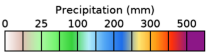
Below is an example of a Snippet map highlighting Zimbabwe with the latest
CHIRPS-GEFs data set.
CHIRPS-compatible GEFS precipitation forecasts for anticipating flood and drought hazards (CHIRPS-GEFS):
CHIRPS-GEFS is a bias-corrected and downscaled version of NCEP Global Ensemble Forecast System (
GEFS)
version 12 precipitation forecasts made to be spatially compatible with Climate Hazards Center InfraRed
Precipitation with Stations (CHIRPS) data. The CHIRPS-GEFS
data set provides next 5-day to 15-day precipitation forecasts, updated daily, at a spatial resolution
of ~5 km across the globe.